The inhabitants were really living on the breadline and illegal whisky making was endemic. The raw ingredients and the finished product were carried in and out of the village, possibly along the very track we were walking on. Peats were carried into the hamlet as there was no peat for burning at the site. The soils were thin and unproductive.
This wall was built to keep Sir John's sheep from straying closer to the sea and ultimately falling over the sheer cliffs, with the consequent loss of profit. No such wall was erected to safeguard the crofters or their livestock.
It was fairly steep downhill to the site of the houses, and the cliffs.
You can see how poor the ground is and why illegal whisky making was seen as a way of keeping body and soul together.
Alexander Robert Sutherland was born at Badbea in 1806 and later emigrated to New Zealand. His son, David, visited Badbea in 1901. By then, only two tenants remained. and the hamlet was finally abandoned in 1911, the same year as the monument paid for by David Sutherland was built, being unveiled in front of a large crowd in 1912.
We were not the crowd, but this is the monument.
There are inscribed tablets listing the names of the people who once lived here.
Ironically, there are sheep everywhere.
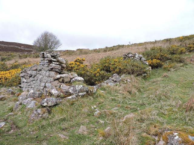
In among the ruins of the crofts.
It is hard to believe that the last people left just over 100 years ago.
We carried on down to the cliff edge, where there were three people sitting, watching the sea. They were looking for whales and dolphins. We joined in for a while.
We were lucky enough to see a couple of Minke Whales, but not lucky enough to get a confirmatory photograph.
There's quite a lot of sea out there.
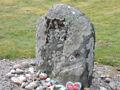
This might be one of the tether stones that they tied children and livestock to, so as to prevent them disappearing over the cliff edges. Then again, it might just be a stone.
Certainly the cliffs were a bit high and steep. Going over the edge was not a good idea. Apparently the excise man would throw the illicit stills and barrels of whisky over the edge when they found them. That is supposed to be why there was a cooper in the village, who spent a fair amount of time repairing barrels, once the villagers had been down the cliff to get the staves and carry them back up. Resourceful, or what?
I spotted a little wren in the gorse on the way back to the car.
When we got back to the car park, there was this very suspicious looking character snooping around the van belonging to the whale-watchers!
After that really interesting wee walk, we travelled south, back to Helmsdale for our next walk. On the way, some of us had a quick stop in a layby to look at this cairn Jimmy knew about.
The cairn commemorates William Welch. He was a very popular local tramp, who visited the area sharpening tools and the like. He died after being caught in a snowstorm in January 1878. He was much respected and the locals erected a stone in his memory. The stone was moved to this spot and incorporated in the cairn when the road was realigned in 2000.
We parked opposite the Timespan Museum in the village and promptly abandoned our bags to disappear into the toilets!
Helmsdale is a Viking name, meaning Dale of the Helmet. To whom the helmet belonged, I don't know. The village was planned in 1814 to accommodate crofters cleared form surrounding glens and straths.
The bridge in the photo, crosses Helmsdale River and was built in 1811 by Thomas Telford. The clock tower behind the bridge is actually the local war memorial.
The new bridge carrying the A9 was built in in 1972. In front of the bridge and beside the old fishing harbour is a Fifie fishing boat. It is well over a hundred years old and is of the type commonly used here. Helmsdale was one of the biggest herring ports in Europe and at the height of the herring boom, there were 200 of these boats crammed into the harbour.
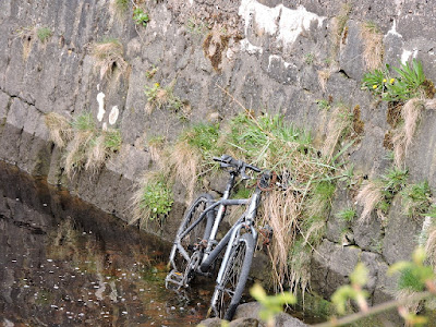
The herring and the Fifies are long gone. All that is left is an abandoned bike.
We walked under the bridge.
I thought someone had laid on a bus just for me, but it wasn't to be and I had to walk like everybody else.
The local lifeboat is a bit on the small side.
This was the Customs House and, it was also the site of a herring curing yard. Herring were extremely profitable. The curing of herring was supported by a bounty paid on the boats that caught the herring, and on full barrels of cured fish. An additional bounty was paid for those barrels that were exported. Many of the barrels were exported to the West Indies and used to feed slaves - they were very high in protein.
When herring were smoked, they turned a reddish brown colour. This building is also known as Red Herring House.
A red herring nowadays refers to something that is designed to distract people from the real truth. This is thought to derive from the practice of dragging smoked herrings across land to confuse hounds. However, red herring were actually used to to train horses. They would get used to the idea of following a scent and not become confused in the noise and bustle of a fox hunt. The use of red herring can be traced to the early 1800's when a journalist, as a boy, used kippers to confuse dogs hunting hares. He then used that story to complain about the press who believed and printed false stories about Napoleon while taking their eyes off true and pressing domestic issues. Nothing much has changed there, it would seem. Well, Napoleon has long gone, but the press is more interested in an agenda rather than truth.
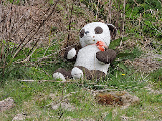
I don't want to panda to any particular theory of the origin of the red herring phrase.
I was unable to find out what the building in the background was used for. It was all shuttered up and might have had some sort of seasonal tourist use.
We soon left the buildings of Helmsdale behind and got onto the coast proper.
Away from the village there was lots to see, or at least, look for.
Like Shelducks and Oyster Catchers.
Neither is likely to have eaten this fish, which might be a big cod, but might not be!
This wasn't a terribly useful sign as we were walking from behind it, so couldn't read it. We might, of course, have missed the corresponding sign at the other end of the dangerous edge. It might also be that it wasn't referring to where we were walking, but more improbably, to the U2 guitarist!
This was a little unexpected. This incised stone clearly means something. A bit of online investigation reveals that it was put here in 2017 and was made by a German artist called Clemens Wilhelm, who was artist in residence at Timespan in 2015. He had developed the piece as a response to an earlier exhibition at the Timespan museum by another German artist Joseph Bueys. Bueys had died in 1986.
The stone is just what it says - a monument to the unknown artist in the same way as there are monuments to the unknown soldier. The location was chosen because it is far away from cities and the tranquillity of the site allows for contemplation of artists and the role that they play in society. The influence of Bueys on Wilhelm is apparent inasmuch as this is a piece with a message, rather than being a depiction of a scene. It is meant to make you think. That is what Bueys was all about. Wilhelm went on to create a piece involving a weeping willow, which was unveiled on the day of Brexit!
We started to leave behind the grassy shore and walked across a much trickier surface of shingle and stone, whilst the coast became even more interesting.
Tricky walking, though.
By now we were needing to have a stop and, perhaps, a bite to eat.
We found a nice spot and Jimmy soon felt the need to take advantage of all the flat stones and build a tower.
It was definitely getting bigger.
Like the Old Man of Hoy. Almost.
Or, maybe something from Ghost!
Charlie was clearly enjoying his lunch.
After a balanced meal, we were soon on our way.
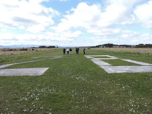
Up from where Robin was practising his releve, was this machinery. Part of some old hydro scheme perhaps. Again there is nothing in the records that I can trace. It looks like concrete, so it is not centuries old.
We soon started to climb up from the shore towards Navidale. Navidale means the Saint's Dale, the saint in question being St Ninian who brought Christianity to much of the north of Scotland.
The rise in height gave us some good views over the bay to the south.
At the top there was a very fine stone wall, enclosing a field of Navidale Farm.
Just beyond the farm, is a small graveyard. This is thought to occupy the site of St Ninian's church and the place where the saint is said to have preached about 390 AD. The church was burned down by the MacKays in 1556 and nothing now remains. There is, however, evidence of pre-Christian remains at the site, suggesting it has long been a place of worship.
It is also the site of some Commonwealth graves.
One of these is for Alex Sutherland, who served with the Canadian Infantry. He died from his wounds and is buried here at the family plot, rather than in France. His Battalion fought at Hill 70, which was actually only 15 feet high! A significant battle took place here in August 1917 and the battalion earned more gallantry medals during this action than any other Canadian force in the First World War.

This stone marks the death of Donald Sutherland, a merchant seaman sailing on the S S Gretafield. His story is quite remarkable. The Gretafield was a fuel tanker built in Newcastle in 1928. She was pressed into service when war broke out and sailed to Curacao to pick up a full load of fuel. She joined a convoy in Nova Scotia and left for Liverpool at the end of January 1940. She struggled to keep up with the convoy and became detached. However, she got across the Atlantic and went round Duncansby Head towards her final destination of Invergordon. On 14th February, she wasn't really that far from her destination when she was torpedoed twice by U57. 27 men survived the huge explosions caused by the second torpedo, which ignited the fuel cargo. The crippled ship drifted for a day in Dunbeath Bay, before running ashore and three bodies were recovered from the decks once the fire had died out three days later.. Whether Donald was one of these, I don't know. He did come from Helmsdale, which explains why he was buried here.

Well, this was a bit unusual - a gravestone simply inscribed "NOT TO BE OPENED". Was this before Christmas, the second coming, or by whoever lies below? I have been unable to find out why this stone was so marked. I assume that it is because the deceased had died from some form of contagious disease, such as smallpox or plague. I've never seen this sort of thing before.
From the not to be opened to the open highway, we walked along the edge of the A9.
We were heading back to Helmsdale, which we could see before us.
It wasn't long before we were back at Timespan, tucking into some very good scones and cakes. It had been a good walk, and the scones just finished it off well.
Then it was back to the hotel for a clean up, refresh and then another dinner - curry, and very good it was too.
Then it was games and bed. Once upon a time, that would have been the other way around.
Day 3 Sunday 21st April
Sunday - our final day. After breakfast, we gathered in front of the hotel for a group photo.
From the hotel, it was a short drive to our first stop at the Emigrant's Monument., just outside the village. You get a fine view form the statue over the village, swathed in yellow gorse.
The statue was designed and made by Gerald Laing. He was a a very famous artist and a contemporary and friend of the likes of Warhol and Lichtenstein. He painted many famous people and his rendering of Brigitte Bardot painted in 1963, sold for over £900,000 in 2014 - a record for his work.
The statue was unveiled in 2007. It depicts a kilted father looking forward to an uncertain future, while his son looks up at him for reassurance. The mother, holding a baby, looks back towards the home they have been forced from during the clearances.
It is a remarkably poignant piece.
"Their voices will echo forever thro the empty straths and glens of their homeland".
Suitably reminded of history, we drove south to the Aldie Burn walk near Tain. By now the sun was shining and it was a good deal warmer than it had been in Helmsdale.
The walk took us through woodland, which smelled fresh from previous rain.
Some remnants of autumn were still hanging on.
There were also some remnants of the older pine forest.
A pigeon watched us walk by from a lofty perch.
This is all that remains of a croft called Mineralbank. It was the holding of William Bonnar who took it over in 1923. He apparently worked every hour of every day to make a living for himself and his family here as the land was so poor. Apparently, turnips were the thing, but even they could not save the family and the croft was abandoned at the end of the 1920's.
It is a bit sad to see years of hard work reduced to a tumble down, overgrown walls.
Susan, Maureen and Sharon came across a couple of old codgers sitting by the path.
Spring was springing in the form of new growth on the larch trees.
Someone has done a bit of chainsaw carving to make a seat.
Where there's a seat there's someone to sit on it. I didn't realise how wide it was. That might not get past the proof-reader!
I guess the boys are not so cuddly and close.
Everyone was a bit closer on the bridge.
Eye, eye.
A wee shelter in the woods.
A guy was passing us on his bike and offered to take our photo at the shelter. Who were we to refuse. He did pretty well, but clearly will never replace the proper snapper.
It wouldn't be a walk without a sweetie from Maureen.
Remarkably, we turn the corner and come face to face with a film crew! That's never happened before. It turns out they were from Highland Wilderness and they were making a film about how wonderful it is to be in the Highlands, with so much accessible walking everywhere. They will sort out your accommodation and adventures for you, for a fee, of course. They are Dutch and they seem very happy to be living here now. I expect we will be very famous in Holland soon.
Unfazed by fame, we carry on.
As seems to be more and more common in woods these days, we stumble on a fairy village!
Fairies and gnomes living together, it seems.
As you might expect, Maureen is thoroughly entranced by the fairy village.
Down below, there is great interest in the fish-shaped pond.
It wasn't far from there to the cars. Once back, we set off for our final destination. Soup and sandwiches at Tomich. They even set aside a sunroom for our exclusive use. Of course, maybe they had heard about us and just kept us separate form the rest of the customers.
Pam shows off her waitressing skills.
So does Maureen.






.jpg)

.jpg)


.jpg)










.jpg)


.jpg)
.jpg)
.jpg)