
LOCHABER SOME MORE
Day1 Monday 17th April 2023
Time for another April getaway, this time south and west to Lochaber. Despite the rainy reputation, the sun was shining on the way down the road from Inverness.


It did start to get a little cloudy as we got nearer to our first walk at Glen Garry Forest, but it looked like it would at least stay dry.

As it was our turn to organise the trip, we were first to arrive at the car park in the forest. At times of high water, the car park can be very busy with canoeists, who get into and out of the river at this point.
Special steps have been erected on the bank to allow canoes to be walked up and down, supported by the wide, low banister.
Sharon was not about to launch herself into the river.

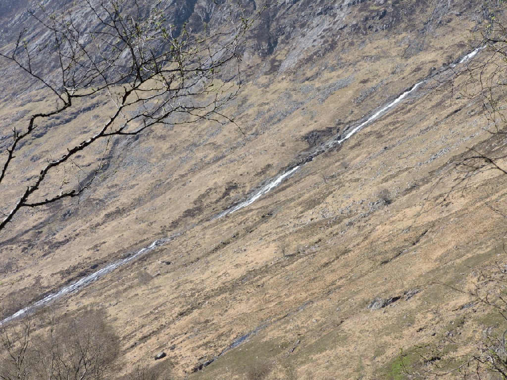
The river wasn't particularly high.


Soon everyone arrived and we hit the trail - in this case the Allt Na Cailliche Trail. This was all a bit confusing. The sign says Caillche, without a second i, the leaflet says Cailliche, as does the Ordnance Survey map. A Cailleach is an old woman, so the walk is most likely taking you to the stream of the old lady. Certainly, you wouldn't want to walk along a Cailleach-Dhubh. That's a sooty snotticle hanging from the roof of an old black house. The River Garry certainly isn't that - it is often described as one of the most attractive rivers in Scotland. The name of the village Invergarry simply means the mouth of the (river) Garry. Garry derives from Garbh, meaning rough, which certainly describes some sections of the river.

The sky was blue as we set off.

Soon, we were on the path beside the river. Sandra was setting up her latest Tik-Tok video.
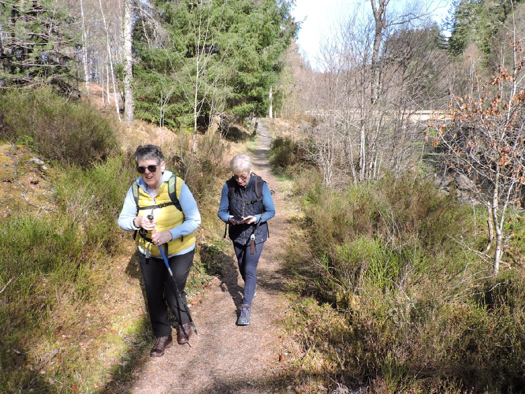
It is almost impossible to walk along a river side, without stopping to look at the water.

Between the river and the forestry track was this deep cut. Jimmy had spotted it and thought it was a Mill lade. He was correct in that it was man made, but it didn't serve a mill. It was, in fact, a canal dug to allow logs to float downstream to Loch Oich without getting caught on the rocks in the river. The lands hereabouts were owned by the MacDonnels who were quite assiduous in making their estates pay. They actually denuded almost the whole of their estates of timber and they cleared their tenants to make way for sheep.

These are the rocks they were hoping to avoid.

The sign wasn't wrong!

We went to the safe bridge instead.

From the route we could see across the hills to Meall Dubh - the black, round hill - and the turbines of the Millennium windfarm. These contribute over £100,000 to the local communities every year.

By now, we were on the tarmac road, which leads, eventually to the A82, although we would not be going quite that far.

It was getting warm in the sunshine.

It was also time for a sweetie. Maureen gave Dave his very own bar of dark chocolate!

Some people seemed perplexed by the choice of sweets on offer.

Meanwhile, there were tadpoles on the other side of the road - a sure sign that Spring is well underway.

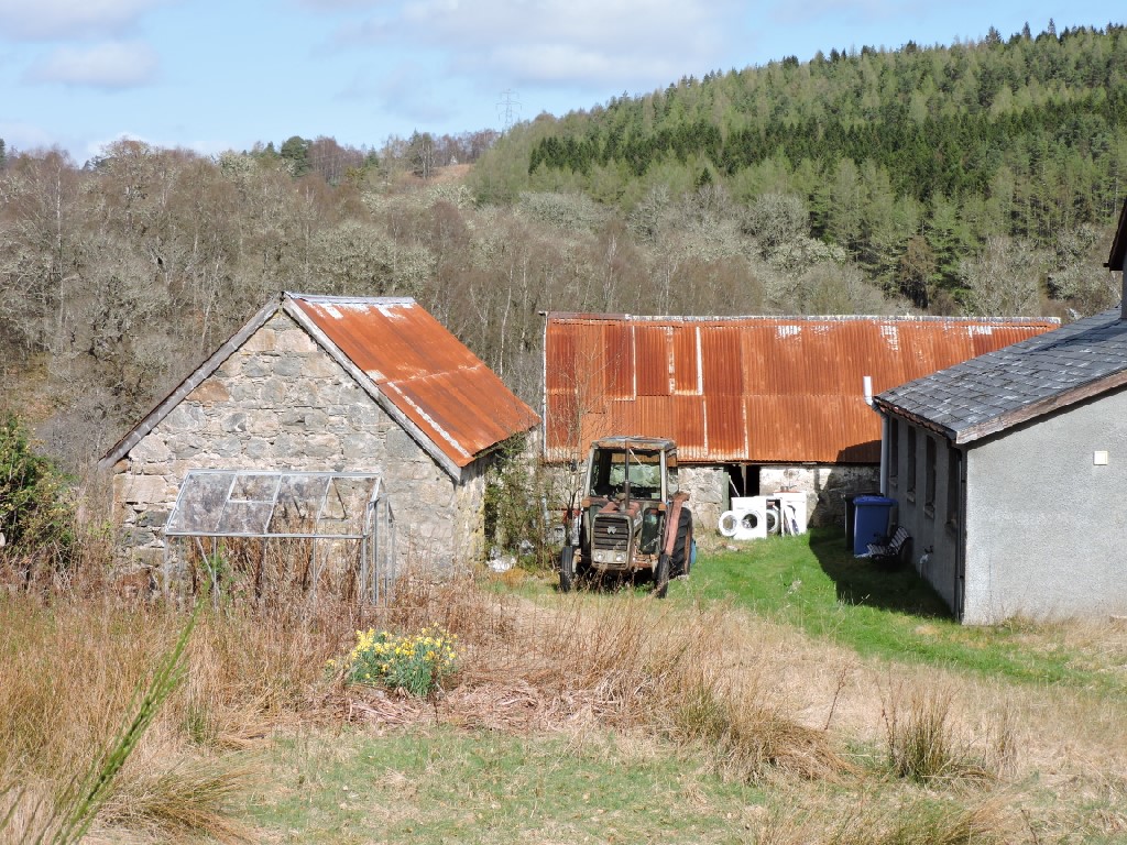
A symphony in rust between the barn roofs and the old Massey Ferguson Tractor.
We were soon off the tar and crossing the field to the river and to the village and lunch.

We had to get through, or round, a gate and then across a bridge. Apparently, the ladies opened the gate and walked through, while the men went round and stepped over the old fence. Well, that is, except for me. I went through the gate as well. Perhaps this was in deference to the age of the gate, which I assume was the same as the lattice girder bridge, which was built in 1892. It was built for Mrs Ellice of Glengarry and Glenquoich. The Ellices bought over the MacDonnel's holdings when they ran out of trees and money.

Lunch - on the specially provided picnic benches.


Others preferred a dancing lunch rather than use the picnic benches.

Jimmy clearly liked his piece.

While we were roughing it in Invergarry, Sue and Charlie were in Fort Augustus sitting in the sun with cakes.

I'm not sure how he paid for his coffee, but he was spotted at the bank looking for a spoonful of sugar.

After lunch we started to walk up the north side of the river and we soon came across these disused and mysterious pipes.


There was also a small hut.

Inside the hut was some disused electrical equipment, possibly pumps.
Nearby there was a salmon hatchery and I think these remains are from an earlier hatchery. The Hydro Board dammed Loch Garry as part of a wider hydro scheme and they instituted a hatchery to restock local rivers affected by the scheme. In the early 70's Marine Harvest took over the hatchery and used the young salmon to stock their salmon farms in the Highlands. The hatchery was producing up to 200,000 young salmon a year when it was decommissioned before the turn of the century.

Talking of young salmon, there were Goosander on the river and they really like to eat young salmon for breakfast, lunch and dinner. Unfortunately, my photo wasn't great!

I'm assuming Dave is getting something out of his shoe, but you never know....

Our next point of interest was a SEPA (Scottish Environmental Protection Agency) river gauging station. This one is called Graigard and sits within the River Ness system. The gauge itself sits at exactly 49.322 metres above sea level. It measures flow generated by a catchment of 399 square kilometres. The highest recorded level was 2.745 metres in 2015 and the lowest was 0.16 metres. Jimmy was looking into the matter deeply.

The gauge.

More gauging. Actually most of the measurements are taken by computers rather than a wee guy coming out and looking at the gauge.

A little further on, we came across this deer. I cannot be certain about the species. My first reaction was that it was a roe deer, but roes have a white chin under their black nose and this one doesn't have that.

However, it looked a bit small for a red deer and it has one horn, so it must be a male. Deer may grow only one horn for genetic reasons, or they may lose a horn. The horn is very like a roe deer horn, but a bit malformed, so it remains a mystery.

So, unaware, we trekked on along the path.

We did see this little memorial next to a seat by the river.
I have been unable to decipher the meaning of the letters on the cross. I assume it is the 1st Battalion (BN) of the 2nd Highlanders (2 D HLDRS)
I can't find an explanation for the other letters, although they might be to do with the Gordon Highlanders - another mystery!

Jimmy and Dave had a well earned rest on the seat.

It wasn't far from the little cross and seat to the bridge and the car park.
It was really warm in the sun now, and we decided to do a further little walk along the Ciste Dubh path. Ciste is Gaelic for a box or a trunk or, more ominously, a coffin. Maybe this was an old coffin road.
So, off we gaily went.

Not long after we got going we spotted this Dipper in the river.
Let me tell you a little about Dippers, because they are quite fascinating little birds. They need fast clean and clear water, so you only tend to find them in highland areas throughout the world. They are unique among perching birds for their ability to dive and swim underwater. They don't have webbed feet, but actually quite big feet and claws, to allow them to hold onto rocks in fast flowing water. They also have special eyes that have special focus muscles which means they can change the curvature of their eye lenses to let them see better underwater. They have solid bones, unlike most birds and this reduces their buoyancy. They keep their feathers dry, by having dense plumage, which they can keep waterproof with large preen glands.
As if that wasn't enough, they can also use nasal flaps to keep water out of their nostrils.
Now, wasn't all that fascinating?

Further on from the Dipper was this totemic natural sculpture. Either that, or somebody was having a bit of fun with sticks and stones.


The turning point of the walk back to the car was not far from the Loch Garry Hydro Dam. The loch and dam form part of the wider Garry-Moriston scheme. The Garry part uses water falling on one of the wettest places in Scotland. In 1954 over 10 inches of rain fell in less than 24 hours! Water is initially collected in Loch Quoich, further west, before passing through turbines and then flowing into Loch Garry. Hydro dams can cause huge variations in river flows, which may well be a problem for Dippers, but they must be managing this well here on the evidence of the Dipper we saw earlier.

We carried on back along the forest to the cars, then on to our hotel, The Old Pines at Spean Bridge. We got into our rooms and then sat down to some very nice tea/coffee and scones.

After our tea and scones we took a short drive up to Loch Arkaig and the Eas a' Chia Aig waterfall. Here are three of our four witches at the eponymous sign.

Here is our male escort at his sign.

The waterfall is slightly unusual in that it comprises a series of distinct falls, rather than a single drop or a slide of water. There are actually other drops above these two, but they are not so easily seen.

They are quite impressive, even without the volumes of water that can sometimes be seen here.

Here we are gathered in front of the witches cauldron. The question is, was it one witch and no apostrophe, or more than one witch with no apostrophe or was it a cauldron for witches?

It is a short step from the cauldron to the shore of Loch Arkaig, which stretches about 12 miles to the west of where we were standing. It is not hugely well known, but the scenery is very fine indeed and the visit was well worth it.


Just when it seemed the scene could not be improved a couple of water nymphs appeared momentarily.

Then, the loch reverted to a more gloomy perspective, perhaps reflecting on the legend of hidden Jacobite gold hereabouts.

There is a nice bridge where the loch flows into the River Arkaig, which then flows into Loch Lochy, which forms part of the Caledonian Canal.

Naturally, I took a bridge photo.

After that bit of sightseeing, it was time to get back to the hotel to freshen up and get ready for drinks before our dinner.
Our first course was a very nice wild garlic agnolotti.

There was a starter of Jersey Royals, asparagus and rhubarb - spring on a plate.

Or, you could have had white asparagus, crab, pickled mussels and apple.

Lots of people went for the main of venison and black pudding.

Others preferred the sea trout on fragola with a caper dressing.

Puddings included chocolate mousse, caramelised banana and peanut butter praline.

Or, a brown sugar parfait with kiwi fruit and sake.
.
After our lovely dinner, we had some games, courtesy of Jimmy and Jacque, before it
was time to retire after a long, full day.
Day2 Tuesday 18th April 2023
We awoke to a beautiful blue sky on Tuesday morning. The view from the hotel through the pines to the Ben Nevis massif was just wonderful - hopefully presaging a good day's walking.

Indeed, Maureen had already been for a stroll with a friend.

After a fine breakfast, we were soon hitting the shops - well Marks and Spencer at least. We all stopped off to buy something for our lunches later in the day. Jacque very kindly agreed to buy everyone lunch. It isn't very often that we have a photo of a supermarket in these blogs, but there is a first time for everything.
Note the sun blazing down from a Fort William sky.

We were going to spend the day in Glen Nevis. Both Ben and Glen Nevis have uncertain toponymy. The most likely explanation for the name is related to the river. Rivers often give their names to places. The name of the river is suggested to be Nebh, meaning cloud - all rivers derive from clouds, of course. Ben Nevis is often shrouded in cloud, although it was not until the Ordnance Survey began in the 19th Century that Ben Nevis was found to be higher than Ben MacDhui.
Another suggestion is nimheis, which is old Gaelic for venomous. Certainly, the Ben has a fearsome reputation among climbers. Happily, we were sticking with the Glen and not the Ben.
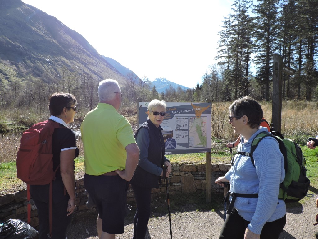
We parked at the Glen Nevis Visitor Centre and headed a short distance up the Glen, before crossing up to the forestry plantation.


Just before we got into the forest I found this pretend (at least, I think it was pretend) £1000000 note on a wall. It looked newly minted with King Charles on the front. Maybe I should have taken it and I would be typing this out in the Bahamas and not at home.

The path took us past the old Glen Nevis graveyard, which is the final home of the Camerons of Glen Nevis, who went by the name of McSorlie. The graveyard is called Tom eas an t-slinnean - meaning knoll of the waterfall of the shoulder. There used to be an iron mortsafe in the yard, but that disappeared some time after it was recorded in 1938. These heavy iron cages were designed to deter grave robbers, who would excavate fresh bodies and sell them to medical students for dissection and anatomy lessons.

Once past the graveyard, we were on the West Highland Way for a little bit. This was much wider and more open and the sun began to get pretty warm.

There were some good views over the Glen.

Looking up the Glen we could see the humps and bumps and outlines of Dun Deardail, which is an old Celtic/Pictish hill fort dating from about 2000 years ago.

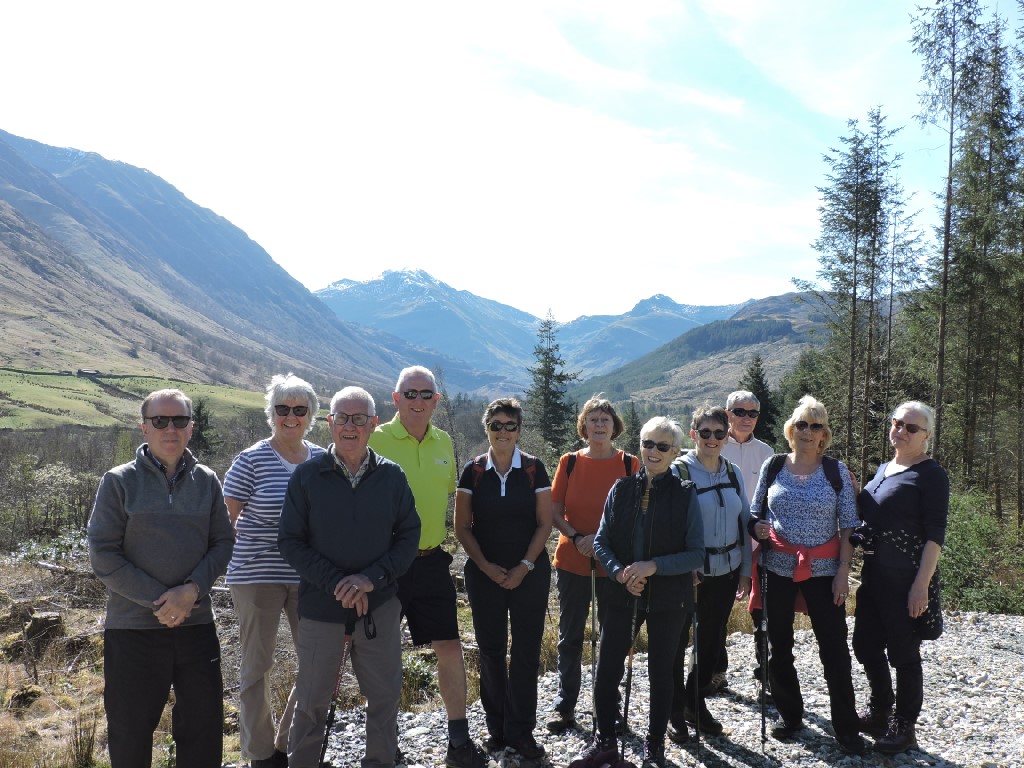
Time for a group photo in the sun.
The route then took us down to the Braveheart car park. The Mel Gibson film, Braveheart was partially filmed here and the car park was left for local and tourist use once the film making was over.
Time for a sweetie break.

Then back to the glen road.

The exciting part of the walk - the Wishing Stone. This glacial erratic was thought to have powers of prophecy. It could answer questions at certain times of the year, when it also revolved. It was called Samuel's Stone - Clach MicShomairle or the Counsel Stone. I climbed on top of it when I was a boy.
People now use Google to look for answers to life's great mysteries, and they hop round the stone three times and make a wish.

Jacque did the hopping for all of us, but was too knackered to make a wish!

We then did a bit of communing with nature, holding hands round the stone.

Then, they started dancing round it.

Who knows what magic this could have unleashed?


Well, we crossed eventually.

We walked upstream along the river bank path. This path is well used as one of the routes up the Ben. Where the Ben route joins our route, there are some convenient boulders to sit on and a sign directing people up the Ben. We thought it worth having our photo taken so that we could at least say we had been on the path up the highest mountain in the land.

Once we had firmly rejected the notion of going up, we went along instead.

The sky was still blue and the sun was still shining.

We crossed back across the river at the Youth Hostel bridge - another point where those going up the Ben will often cross the river. What we didn't realise as we were crossing the river, was that we were walking on history! The original bridge was built in 1949 to allow walkers to cross the river as the ford they used up until then was often too deep to cross. The 50 foot steel girder on which the footbridge sits was salvaged from one of the two Mulberry Harbours used during the D-Day Landings. How remarkable is that?

We walked back along the public road and then cut up towards the forest, passing what I thought was an odd looking mound and wall/ditch. Sure enough, it was something archaeological. It is thought to be mediaeval in date and possibly the site of the MacSorlie chiefs, who you will remember were a sept of Clan Cameron. Cameron of Glen Nevis still lives in nearby Glen Nevis House. This site is known as Dun Dige - dige being old Gaelic for an enclosure on the form of a wall or ditch. Dun would mean a fortress or a raised mound.

We were soon heading into the trees.

Almost primordial looking.

After a short walk along the forest tracks, we cut down again to return to the visitor centre. We should have have stopped and had our photo taken at this sign, but that would have been more of a cheat than pretending we had climbed the Ben.

By now it was time for us to sit down at the specially organised picnic benches and have our Marks and Spencer lunches! Poor Hugh no mates was looking hungry and forlorn.

Here comes the dinner lady, laden down with lunch while Sandra and JImmy watched on.

After lunch we drove to the Lower Falls car park, where we got out for a look at the falls. The falls were not at full flow, but they are quite impressive and a little bit scary. For a number of years there was a race down the river from here, involving jumping over the falls with your "boat" which was a lilo! If you really want to see more, use the link below.

Another bridge!

Dave being adventurous.

After that short stop, we drove to the end of the road and got out the cars for our final walk of the day. Despite me telling them how tricky this walk might be, they all decided to go.


But, soon gets a bit more tricky.

The woodland is very nice. No doubt this is what must have given rise to a thriving charcoal industry in the past. Just above the car park there are at least 20 large recessed charcoal burning platforms. They are much damaged by water and land slippage, but they do suggest a heavily wooded area that was used on an industrial scale.

Occasionally, the woodland opens up, allowing views down the glen.

Some of the intrepid team away ahead of the slower members of our group.

We all got together for a group photo.

Meanwhile the river was crashing through the increasingly narrow gorge, filled with enormous boulders and fallen rock. It was almost like the Himalayas.

Before too long we emerged from the gorge into much more open countryside, with a waterfall in the distance.
This is what we had come here for. Not Susan and Sharon, but Steall meadow and the Steall waterfall.

Looking back, you would hardly know that the gorge and the raging river were there. The flat meadow is just so unexpected.

The waterfall is also unexpected. It is known as Steall falls or An Steall Ban, which is Gaelic for the white spout. The falls are the second highest in Scotland, with a single drop of 120 metres. Harry Potter's Quidditch Olympics were filmed with this as the the backdrop.
The glacial erosion of the softer rocks here left the classic hanging valley from whence the falls fall.


Sharon feels that you should be able to see herds of dinosaurs rushing across this landscape.

Some might think it was a romantic spot, others might wonder if Hugh had water on the brain?

Soon, it was time to go back as we had left Liz on the path where she had felt unable to continue.

Some of us had gone further towards the waterfall, stopping at the notorious wire bridge. Apparently, this is more stable than you might think, but that thought would not entice me to go over unless the herds of dinosaurs were chasing me.


Going back, you are more likely to look at the view down the glen, which would have been over your shoulder on the way up. This is the huge water slide above the car park. At 350 metres it is one of the longest features of this type in the country.
Of a less tectonic scale there were loads of Primroses everywhere we went.

We soon met up with Liz and, when we were all reunited, we had a celebratory photo.


They spent some time at the recently opened National Trust turf house. This house recreates one of the many houses that would have been here at the time of the infamous Massacre of Glencoe in 1692. It would have been in a house like this that the Earl of Argyll's government troops lodged, eaten and drunk with the MacDonalds for 12 days before they put 38 villagers to the sword. Many more died when they fled into the snow covered countryside as their houses were destroyed behind them. All this was because the Clan chief had been delayed by weather in pledging his allegiance to the King.

The house sits on the site of an archaeological investigation of the original building. It took from spring 2021 to the autumn of the same year to build the house. It is thought that 350 years ago it would have taken days with the involvement of the whole community.

The large timber frame of the building is made up of crucks. These frames were often re-used as houses were built and rebuilt. They are held together by wooden pegs and you can still see cruck framed houses to this day.

These cruck frames supported the walls and roof. The walls were made from wattle - interweaved freshly cut green wood, which gave the houses another name - creel houses.

The floors were finished in stone flags, or sometimes, beaten earth.
There was no chimney and the peat fire would have meant it was pretty densely smoky inside, which helped to keep down insect infestation.

Charlie outside his new home.


Coincidentally, we all arrived back at the hotel about the same time and we sat in the sun outside for our teas, coffees and cakes and biscuits. We were not alone, however, as the hotel goats seemed to be enjoying the sun as well.


Once we had finished feeding the wildlife, it was time to freshen up, rest and prepare to be fed ourselves. Time for a pre-dinner drink.

Dinner tonight included confit Jersey Royals with Black Garlic.

Cured sea trout with remoulade and grapes.

A cheese and chive risotto.


Sea bream with tempura samphire.

Pork cheeks with onion puree, wild garlic and apple.

Rhubarb with yoghurt parfait

Oat mousse with chocolate and peanut crunch, which was so much better than it looked.

Following dinner, more games, then bed after another long, but good day.
Day3 Wednesday 19th April 2023
Another morning and another brilliant blue sky to look at while we ate our breakfast.

I think the goats were a bit hungry as well.

There is the cake thief, probably waiting for a slice of bacon.

Before we left for our final walk of the trip, we had our photo taken outside the hotel.

As it happens, the walk we were doing started just across the road from the hotel.


More stile.

Off we went down over the moor on a good path. This path was made possible by the generosity of Dr Alan Reece. He was an entrepreneur and engineer, who built a vast fortune out of the design and construction of undersea trenching machines. He was actually an academic, who worked out that trenches could be dug on the seabed to carry all sorts of pipes and cables. Essentially what he did was design supersized underwater agricultural ploughs. However, Universities were not alive to the possibilities of money making spin offs from research, so he had to leave and set up his own company.
He was also a mountaineer and climbed often in this part of the world. The walk combines a number of engineering points of interest with great views into the Grey Corries and the Ben Nevis massif.

It wasn't long until we were walking along the first engineering marvel - General Wade's Military Road, running from Fort William to Inverness. This was the first of Wade's roads to be built in 1726/27 and was designed to move troops and equipment quickly through the Highlands to supress Jacobite Rebellion. Of course, the same roads allowed the Jacobites to move just as quickly!
The roads were generally of a standard 16 foot width and cost about £90 a mile.

You also get the views from the road.


Through the trees from the military road, we could see some of the remains of the Invergarry and Fort Augustus Railway. This was opened in 1903. The line was largely thought to have been a precursor to a line going all the way through to Inverness, but that had been stalled by politicking and dispute. Clearly the proposers of the line to Fort Augustus from Spean Bridge had grand ideas when you consider the expense to serve the population of Fort Augustus, which a that time was only 500, although there was a military presence there as well. The station at Invergarry had 4 goods sidings and a separate loading bay for cattle, all over and above the requirements for passengers.

Not far from the line of the railway is High Bridge. This carried Wade's Military Road and was completed in 1736. Once it had fallen into disrepair it was replaced by the Spean Bridge, which was designed by Thomas Telford - more engineers.
High bridge is the location of the first shots fired in the 1745 Jacobite Rebellion. A dozen Highlanders commanded by Major MacDonald of Tirindrish (which isn't too far away) ambushed and routed 2 companies of the Royal Scots. They had fooled the government troops into believing they were faced by a much larger force, by running about, shouting and playing the pipes. The troops ultimately retreated and were eventually surrounded by a larger force of rebels. The commander of the troops was wounded and two men were killed, but on surrender all were spared by Major MacDonald and, later, Cameron of Lochiel. Much later Major MacDonald was captured at the battle of Falkirk and beheaded, which seems a little harsh to me.

The ruins of the bridge are pretty impressive it must be said.


Not very much further along the walk are the remains of the railway bridge across the river, which are just about as impressive, but they don't have the Jacobite romance attached to them. As an aside, I was once told by Cameron of Lochiel that our common surname is, of course, an anagram of romance!


Sharon is clearly transported by the romance of it all.

Enough of that, we had a walk to do.

This is the attractive little parish church of Kilmonivaig, built in 1812.


Some of us obviously need more than a seat on a bench.

Some of the ladies were happy to take advantage of the seat.

The bench was dedicated to Alan Reece, the engineer and mountaineer, who's foundation had built the path we had walked along.

We wound our way, somewhat circuitously, up to the church and the adjoining graveyard.

Some of the gravestones had stories to tell.
This one mentions Una Cameron who was killed in action in Salerno. She was a nurse and a midwife, who was aboard the Hospital ship Newfoundland when it was attacked by German aircraft in September 1943. No wounded were on board, but six nurses, all the doctors and some of the ship's officers were killed.

This very rustic gravestone is in memory of Kenneth MacLeod and his wife Catherine. They had 8 children in a 16 year period. 3 of these died before their 8th birthday!
It is a fascinating stone and there has to be a real story there, but I can't track it down.

I suppose if you had to choose a graveyard, there would be worse places to be.

From the peace of the churchyard we were walking up the busy A82 towards our cars and the hotel.

The breadth of the view was worth the traffic noise.

Our final stop was the Commando Memorial.
This iconic sculpture was erected in 1952 as a memorial to the officers and men who of the Commandos who died in the Second World War. The land at Achnacarry was where the Commandos were trained.
The site of the sculpture allows for awesome views to the hills, but it also sits on the route from Spean Bridge railway station and Achnacarry Castle where the Commandos were stationed and trained. To get there, prospective commandos would get off the train at Spean Bridge, load their kit bags onto trucks then speed march to Achnacarry wearing full kit and carrying their weapon, all of which weighed 36 ponds. Anyone who failed to do the 7 miles in less than an hour was immediately rejected as a commando and sent back to their units.
I suspect not many Dinosaurs would make a commando.

It is, to me, at least, astonishing to find out that this sculpture is of real commandos and not just a representation of all commandos, although it is clearly that as well.
The sculpture was designed by Scott Sutherland in 1949 and his design won a competition, with a £200 prize. He was an award winning sculptor, born in Wick and he served in the war along side commandos. He was the head of the School of Sculpture at Duncan of Jordanstone College of Art from 1947 to 1975 and died in 1984.
The men depicted in the sculpture are Commando Jack Lewington, who often attended memorial services here, which must have been a little surreal.
Frank Nicholls, whose rank is unknown, and Regimental Sergeant Major Sidney Hewlett, who was hand-picked as one of the founding NCO's of the newly formed Commando regiment. He was held in high regard by Eisenhower, no less.
Maureen and Dave give you an idea of the size of the monument, which is over 17 feet high. It was formally opened by the Queen Mother in 1952.

The view from the site is pretty epic.

The site has expanded over time to include memorial gardens and areas of remembrance. Many of the original World War Two commandos have had their ashes scattered there. More contemporary commando regiment members who died in subsequent conflicts are also remembered at the site.


It would seem that this was always the case. There was no parade or ceremonial drill at the unveiling of the sculpture. The Queen Mother simply asked to return to her car between 2 lines of commandos.
Today, bus loads of tourists come to look and wonder.

We soon left the monument and the tourists behind and headed back to the cars.

Here is the hotel looking through the Old Pines.
We had had a great time at the hotel and in Lochaber. I'm sure we will be back one day.

After an abortive attempt to have lunch in Fort Augustus on the way home, we managed, through Jim and Jacque to get tables in the Whitebridge Hotel - which is where we will be staying in November! Lunch was very good, so we are looking forward to it already.
posted by bobcam | 11:45:00 AM
|
0 comments
![]()