
NEVER FORGET EARL WILLIAM
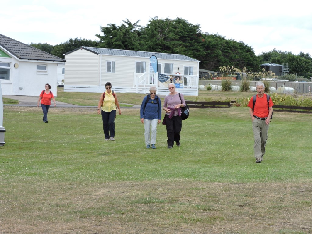
July found us in Dornoch, apparently after having previously been here in 2006, when we were all a good deal younger.
Dornoch, of course, is a good deal older than any of us. There is evidence of settlement here from the 8th Century. Dornoch derives from the Gaelic Dornach meaning the place of pebbles. Sounds a bit odd, given the beaches are largely sand. There is some suggestion that the pebbles, or fist sized stones, relate to weapons rather than beaches. Sounds even more odd to me.
In any event, Dornoch doesn't really appear as a place in writing until the early 12th Century, when King David tells the Earl of Orkney to leave the monks at Dornach alone!
The Dornoch Castle Hotel, at the far end of the photo was once the home of the Bishop of Caithness. The building was constructed in the early 1500's and has been significantly altered since then.

The Dornoch Burn flows through the town. It was canalised before the 16th Century and runs alongside some nice houses. The little bridge near the centre of town is dated 1800 and replaced an original bridge from at least 1562.

The Thompson Brothers are famous in whisky circles for putting together one of the finest whisky bars in the World at Dornoch Castle Hotel. They branched out into making whisky and gin at the back of the hotel and this is where they store their casks for filling with whisky in the fullness of time.

Dornoch Station dates from 1902 and connected the town (and Embo) to the National Rail Network at The Mound. Dornoch was the terminus. Dornoch would have been a station on the main line from Inverness to Wick if the Duke of Sutherland had not insisted on the line going through Ardgay, even though a crossing of the Dornoch Firth at Meikleferry would have been possible. The line from The Mound to Dornoch opened in 1902 and was the first light railway in the Highlands. It closed, courtesy of Beeching, in 1960. Interestingly, Andrew Carnegie spoke at the opening of the line and had expressed a wish to see a through train from Inverness to Dornoch as he was greatly enamoured of the place. Such a train was introduced for a while on Fridays in summer. You could even get a sleeper from Glasgow to Dornoch. Eventually, a through train would only run to Dornoch if a whole carriage had been booked!
There was some debate on the walk about whether the station building was used to sell boomerangs! The answer is - yes it was! The station was used from the early 1980's by Treecraft. A guy called Donald MacDonald used to carve laminate boomerangs for sale in the craft shop. I think he worked for Treecraft Woodwork, a company making timber doors and windows and who still operate out of Dornoch, but not at the old station. I guess he may have used off cuts from the timber business to make somewhat unusual laminated rangs as us officianados call them!
By the way, what do you say to a boomerangist on his/her birthday?
Many happy returns, of course!

Opposite the station, we head into a nice little woodland, called, well, Station Woods.

We followed the cat marked trail. The cat is taken from the crest of Clan Sutherland and is rather fancifully known in heraldic circles as a cat-a-mountain. We would call it a wildcat.
We pressed on without fear, which was good as the motto of the clan is sans peur. That is French for without fear, but it sounds a bit like Sam's Purr, which would be funny if the cat was called Sam, which it isn't.

It being a woodland, there was a tree swing and Robin was off! He was so quick that the photo was a bit blurred.

There were glimpses of farmland, and tatties, from inside the woods.

Sandra had to stop to take a phone call.
What a popular lady she must be.

Our next stop was a gravestone. In the middle of nowhere and certainly not near any consecrated ground that we could see. There might be a reason for that!
The OS map shows a small hill - only 23 metres above sea level - near to where we stood. This is called Gallow Hill and was known to be a site of executions. There may well have been a cemetery associated with that. There is no obvious sign of an enclosure to define a graveyard. There is this tombstone, though.
This was erected by the son of a man thought to have died of cholera in 1832. The town had posted guards to ensure that nobody with cholera was admitted. This poor man had died, it was thought of the disease, so he was buried on the spot. There was a bit of a stigma surrounding cholera and the tombstone states that eminent doctors afterwards testified that he had not died of cholera.
However, the National Record of the Historic Environment for Scotland (NRHES) records a cholera graveyard at this location, with this being the only visible headstone.
Now, there seems to be two explanations.
The wee interpretive board nearby says the use of guards kept the town free of the disease. Of course, if there was that stigma, maybe they did not record cholera deaths, nor did people want headstones of victims of cholera to be erected, for fear of the shame on the family name. The son of this victim was sufficiently upset about the stigma that he made sure the rebuttal of the cholera slur was mentioned on the headstone!.
The NRHES is wrong and the tale is right
I prefer to think that the tale is the real answer to the riddle.

More stones. This time, the Earl's Cross. This is reputed locally to be a 12th Century cross erected to mark the boundary between the Lands of the Earl of Sutherland in the north and the Bishops of Caithness in the south. That is likely to be the case, except that the stone is much later than the 12th Century. The triangular hole in the stone is actually the remains of a larger cross with extending arms. However, the stone is thought to be the boundary marker and rights of sanctuary at the nearby Dornoch Cathedral probably did exist.

It is a bit easier to see the remains of one of the carved armorial shields delineating land ownership. The shield is on the thick band around the shaft of the cross.
The interpretive panel refers to another cross nearby marking the site of the battle of Embo in 1245. Some other sources suggest the battle took place in 1259. Not only is the date unclear, but the stone no longer exists!
No matter where or when it was, the Vikings had become a bit unruly. William of Moray had sent his servant, Richard Moray (probably a relative) to hold the Vikings until he could get there with a bigger army. He did and the Vikings were defeated. Poor old Richard was killed and was buried in the cathedral at Dornoch. William allegedly killed the unnamed leader of the Vikings with the severed leg of a horse. Leg end has it that this is why a horseshoe is found to this day on the coat of arms of both Sutherland and Dornoch.
Not only did poor old Richard get a great burial, there was a statue erected for him and a cross erected for him at the battle site. This is the cross that has now disappeared! The cross, while it was there, is thought to have marked the graves of a great many warriors killed in the battle along with poor old Richard.

From battles to little people. The next stop was an extensive fairy village in the woods. I was going to say that Maureen was beside herself. That is patently not true as you can see below.

Nobody was made to feel unwelcome and nobody disappeared for years, so I guess we all believed in fairies!

There were fairies up trees.

There were butterflies on the ground.

There were fairy houses everywhere.

There was a wise old owl called Bob - at least that's what he told me.

There was a Rainbow Lane.

There were fairy caravans.

There were little bunnies.

That was fair enough.

As an antidote to all this sweetness and light I found this nearby.
It is, of course, a Stinkhorn, Latin name Phallus impudicus. I'm sure you can see why it got the Latin name! It gets smelly at times and it can grow by 4 to 6 inches in an hour.
It was considered so rude looking that gentlemen would hasten to the woods and flatten them with clubs before demure young women went walking and stumbled into them.

Once we were out of the woods, we got some views across the Dornoch Firth.

The views also included the Royal Dornoch Golf Course.
The course was first laid out in 1877, when it comprised 9 holes only. The committee were ambitious and engaged Old Tom Morris to lay out a fully planned course in 1886. The invention of rubber cored balls meant a further remodelling to accommodate the faster ball and Dornoch was at that time the 5th longest course in Britain. It became Royal in 1907, being granted title by Edward VII.
During the Second World War an aerodrome was built on the 18 hole ladies course and 4 holes of the championship course were also lost. This brought about the extension of the course north towards Embo.
In 1883 the annual membership was 2/6. A round today would cost you £210.

On the other side of the track from the golf course was a field of Borage. Well, it is a member of the borage family, but the scientific name is Phacelia tanacetifolia, more commonly known as Lacy phacelia or blue or purple tansy. It is often grown to attract insects or most likely here, as a green manure. It has highly branched roots which break up compacted soil and when it decomposes many minerals are released including phosphorous, calcium and magnesium as well as very high levels of nitrogen. It can prevent nitrate leaching from soils.
The whole idea of green manuring of fields is to disrupt disease and pest life cycles, improve soil fertility and nutrient levels, and to suppress weeds.


At this point the group broke up into the bluies and the redies. I don't know why.

Away across the Dornoch Firth was the Tarbatness Lighthouse, which dates from 1930, although it was rebuilt in 1892. It is also the site of one of our very earliest walks as well as the spot where we almost lost Susan to the bog.

Over the fields is Embo House. This is the site of the castle of Embo, which belonged to the Gordon family. The original house is to the right of the picture and it was part of the earlier castle. Towards end of the 18th Century, the house suffered a serious fire and the last of the old Gordon family to live there was the 5th Baronet, who died in 1779 with, apparently, mountainous debts. The house was bought by a Robert Hume Gordon, who rebuilt it lavishly in 1799. His ambition was to become an MP with a country seat to rival the Duchess of Sutherland. Once he built his new house and entertained the local electorate, he promptly lost the election. And here was I thinking money could get you anything in politics!
The house is very handsome and you can rent it out for large groups. It has 8 bedrooms and 3 nights would cost £3150. In addition you can buy in housekeeping and catering - including breakfasts - for an undisclosed fee. Just saying.

Here is Tractor Ted cutting down the blue green manure.

Walking through past a field of oilseed, we put up a flock of what I think are Siskins - probably feeding on the seeds.

Before too long we start to walk through the caravan park at Embo. Embo is a Viking name, meaning Eyvind's steading. Eyvind being an old Norse personal name.
Being a caravan park, there are toilets and most of us stop to take advantage of this. More and more, we have to take facilities like this into account on walks.
Sharon and Robin wait for the toilet rush to finish.

Here is the toilet rush.
Embo pier is now almost ruined. It was built in 1895, although there was a small local fishing industry in the village before that time. This is a little unusual. Organised fishing villages were constructed by the Sutherland Estates to give employment to crofters cleared from inland areas. However, Embo was not part of the estate, belonging to the Gordons, of Embo House. However, the pier was built in a place subject to winter storms and it did not last. The only use these days is of the nearby slipway by small pleasure craft. People also fish from the old pier and Embo beach is a well known flounder hotspot in sea angling circles.

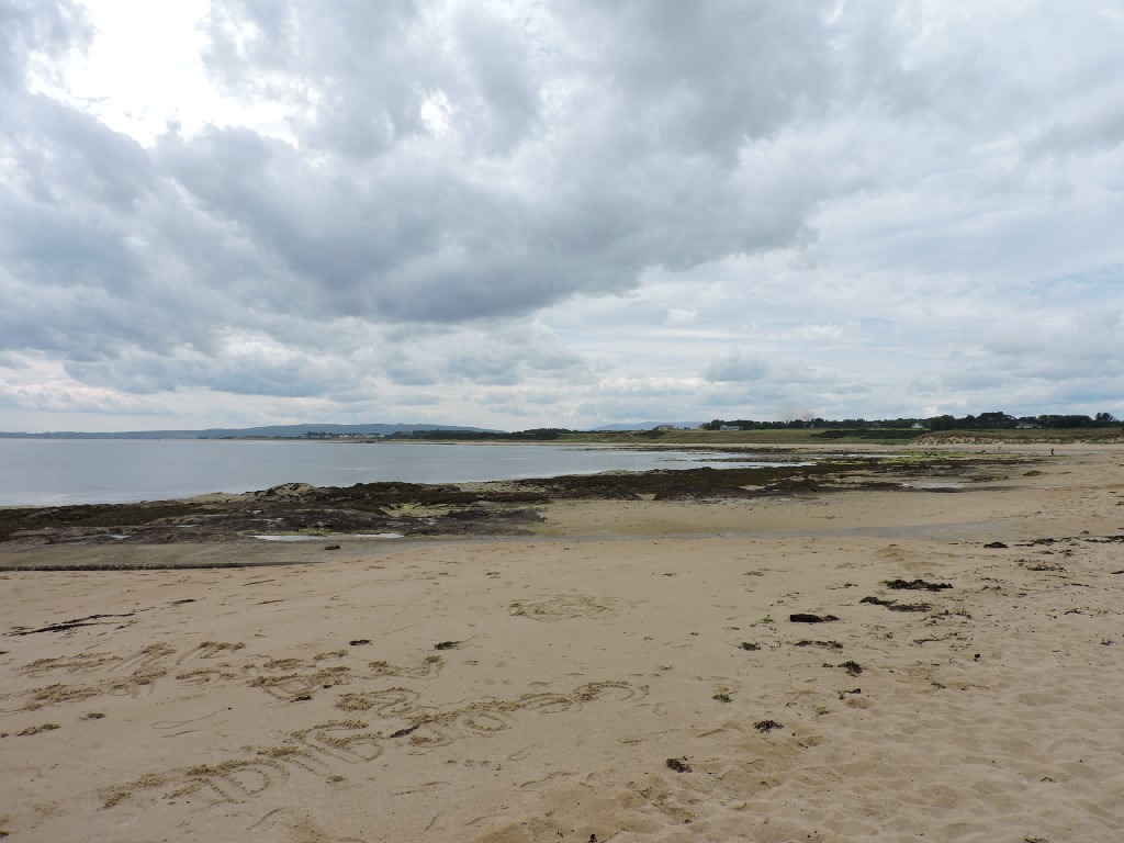
This was the view form our lunch spot. Looking along the beach, we were unaware that the very same beach had been used by stone age men who left behind a stone axe-head rediscovered in 1980. Perhaps these were the same people that built the burial cist at the car park to Grannie's Heilan' Hame.
Grannie's is famous all over the country and the world. That is mainly as a result of the Andy Stewart song of the same name, which is about a wee cottage in Embo, although there is no guarantee it is actually the same place!
Here we are having our lunch.

Sharon off looking for lithic implements. Stone axe heads to you and you. Having a certificate on field archaeology I knew that already.

Off along the beach we went, heading back to Dornoch.

We did head a bit too far along the beach and some of us missed the trail back up to the path along the side of the golf course.

Here is that path.

An oystercatcher sitting on the beach.

Golfers on the skyline.

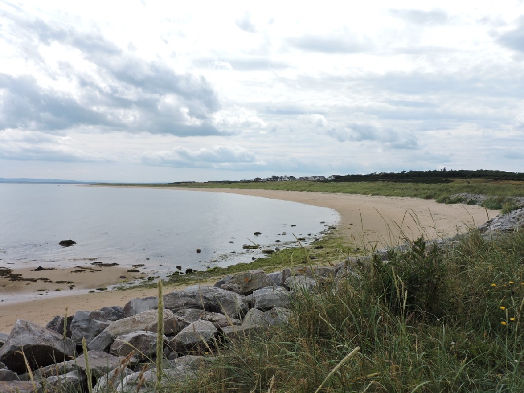
The sweep of the bay, you can see why the area was so attractive to Vikings and golfers.
The path took us back to the beach, when we really should have gone back across the golf course. We found the way eventually, but not all at once.

This is the way we should have gone.

Indeed, we did.

The wayward stragglers soon joined us.

Back into the wood we went.

Time for tea and cakes. Cocoa Mountain was the place of choice and some people bought a mountain of chocolate.
Some people just didn't know where to look.

That was the end of another walk in pretty good weather with pretty good company.
Just for old time's sake, I've included a couple of photos from the last time we were here in July 2006, almost exactly 16 years ago to the day.
Here we are at the end of the walk enjoying a cold beer at Sue and Charlie's campervan. Oh! How times have changed - no beers these days, but we were so much younger then.

We did have lunch at the same spot, though.

Clearly some of us were keen on more than just walking with each other!

Whatever next?
posted by bobcam | 6:15:00 PM
|
0 comments
![]()