
FORTROSEMARKIE, AND THE POINT IS?
Our first walk with the benefit of 2020 vision. We didn't have to go too far from home to meet up on the Black Isle at Fortrose in the shadow of the ruined Cathedral.
Of course, the Cathedral has not always been here. In fact, it used to be in Rosemarkie where we were going to be walking to later on.
The Cathedral at Rosemarkie is thought to be one of a number set up by King David I, of Scotland, who reigned from 1124 to 1154. King David was hugely reformative of the running of the kingdom, setting up many of the institutions that remained in place for centuries. He founded burghs and markets, instituted feudalism and also set up a number of bishoprics and Cathedrals.
The Bishop of Ross moved the cathedral from Rosemarkie to Fortrose and the present building was started in the first half of the 13th Century. It was hacked about and extended on a number of occasions until, like many Cathedrals was allowed to decay from the time of the Reformation in 1560. The lead on the roof was offered to Lord Ruthven in 1572! Cromwell is said to have removed a lot of stone from the site to construct his citadel in Inverness. Fortrose is one of the more ruinous of the 13 medieval Cathedrals in Scotland.

However, all of this interesting ecclesiastical history was lost on us as we tried to keep warm and contain our mounting excitement about the forthcoming walk.

Everyone had a hat on - even me, and I certainly don't suit a hat, but my lugs came first.

We walked up to the High Street, past the Fortrose Market Cross. This has lost its head, which is a common enough occurrence.
Speaking of heads, Fortrose comes from the Gaelic Foter which means beneath, and ros meaning cape or headland. Fortrose sits below the Rosemarkie Headland.

The next part of the town we came to was the harbour.
Any town worth a candle had to have a harbour. Everything was transported by sea - there were no railways and roads were rudimentary, at best. A harbour was the thing. Prominent men in the town decided to petition in 1813 for an engineer to get a survey done and a harbour costed out. The engineer turned out to be Thomas Telford. He thought it could be done for £3500. He was miles out - it cost £255000! Actually that was in today's money, it cost £4016 back then.
It opened in 1817 and by 1870 it was a hive of activity with a distillery, sawmill, gas works and mason's yard nearby.

Just as people now commute from Fortrose to Inverness, there was pressure for a ferry service to be put in place. It was impossible to run a scheduled service as the harbour dried out at low tide. The solution was a pier, which was to be built out from the harbour wall.
The pier was built in 1872 and ferry services were run by the grandly named Black Isle Steam-Ship Company. However, the coming of the railway in 1894 proved too much for the steam ships and the pier fell into ruin and was eventually destroyed in a storm in 1927.
Given the wind on the walk, I can believe that.

We walked up the brae from the harbour.

This gave us some nice views to the west.

The road up the brae is called St Andrew's Walk and it leads you to St Andrew's church. What a coincidence!

Clearly the parishioners of St Andrew's are very caring and open hearted, willing to love any of their neighbours. There are one or two Dinosaurs that we know do not share the same feelings to their fellow men.
No names, no pack drill!
But, you know who you are!

The church was built in 1812 and was restored in 1891. There are records suggesting that payment for works at the church were not always made in a timely fashion and debts had to be pursued by tradesmen.
Given the parlous state of the cross on the roof, perhaps the work wasn't done to the best of standards, hence the late payment.

We walked down from the church towards the sea and Chanonry Point, named in Gaelic as the headland of the canonry after the cathedral and, some suggest, the castle which was once thought to stand here.

We passed a number of these trees growing inside the walls of the houses nearby.
This looks like Garrya Eliptica or the Silk Tassel Bush.
It is a native of coastal California and Oregon. It is very hardy and is often used in coastal settings as a wind break. It is named after Nicholas Garry who was the Secretary of the Hudson's Bay Company from 1820 to 1835.

It was extremely windy down by the sea and there were squally showers being blown in from the west, but luckily these passed us by and we stayed dry all day.

Even the gulls found it hard to make headway against the wind.

This Robin found a sheltered perch.

It certainly was not sheltered out on the water.

We walked alongside the golf course, where there were some very hardy souls out playing, two of whom managed to play their balls onto the shore despite the howling gale off the water.

A view of the ice house from the path. This is actually double vaulted, you just can't see that because I didn't go round to the front to take the photo. It dates from the 19th Century and may be associated with the nearby ferry pier.

A first view of the lighthouse, poking up between two gables. The lighthouse is 13 metres high and the light shines every 6 seconds, with a range of 15 miles. That might get a wee bit annoying if you lived in the house next door. Sandra would be frantic about all these cars coming and going all night long.

On we went to the dolphin car park. By now the salt in the air seemed to be coating my lens, so the photos are becoming ever more hazy.
The point here is reputed to be one of the best places in the world to watch dolphins from the shore. It can sometimes seem as if the whole world is down there doing just that.
Not today, though!

I don't expect that the Brahan Seer had the inclination to watch the dolphins as he was burned to death here in a barrel of tar.
He made the mistake of telling the Countess of Seaforth that her husband was late home because he was dallying with a younger, better looking woman in Paris.
Just goes to show that you should think very carefully about what you tell a woman.
This almost illegible plaque marks the spot where all of this was supposed to have happened.

Walking past the lighthouse, I doubt if anyone took the time to notice the Egyptian style houses associated with the tower. The tower is very similar to that at Cromarty, because they were built by the same man. He was Alan Stevenson, of the Stevenson lighthouse building dynasty. This one was built in 1846 and, if anyone had looked more closely, I'll bet they would have been amazed by the innovative bronze lantern with inclined astragals. These inclined astragals were designed to minimise obscuration of the light beam.
Notwithstanding this innovation, the 150 ton schooner Amalia carrying coal to Oslo was lost on the beach here in 1888.

If you look very closely you can see the astragals in this photo.
Maybe.

This is the point nearest Fort George on the other side of the Firth. You will recall, if you were paying proper attention, that I mentioned a ferry pier. It wasn't here, but back near the car park. I did take a photo of it from the beach, but it was no good.
Anyway, the pier was built by Telford and the good old Black Isle Steam-Ship Company visited here once a week.
There was also a ferry from her to Fort George, which ran until 1953.

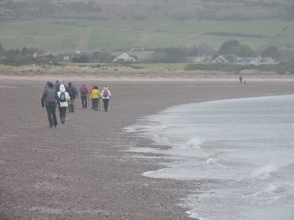
Once round the point, we walked along Rosemarkie beach and were rewarded with a large degree of shelter, which made walking a bit less of a struggle.

There was also an amazing sky.

Onward to lunch we trudged.
The skies were wide.

Aliens had landed on the beach when we weren't looking.

We all gathered round for a sweetie, but Maureen wasn't there. She had abandoned us for her real family.

Just to show how sheltered it now was, these gulls sat on the top of the church. They could not have done that on the other side of the point.

Even the dolphins had come out to enjoy the more benign conditions.

Well, actually they hadn't. I just took a photo of a photo on the interpretive panel at the cafe where we stopped for lunch.

Here is one group of happy eaters.

And.here is another.
I SAID, HERE IS ANOTHER, PAM!!!

On the side of the cafe is this mosaic, put in place on 2013. It is one of a number throughout the Black Isle based on the Gaelic Tree Alphabet.
The letter H is Uath in Gaelic and is represented by the Hawthorn tree. The panel shows that on the left. The other panels show locally important sites such as the Fairy Glen waterfall and sailing on the Firth.
Rosemarkie was once more important than Fortrose - the Cathedral location being the key to that. The name derives from the Gaelic Ros meaning Promontory and Marc, meaning horse. You will remember that wee Gaelic lesson from last month's blog and the derivation of Merkinch. If you don't, then go back and read it again until you know it off by heart.

I expect the horses did not eat the Teasel.
That's not to say it is a useless plant. The heads are still used today by individual weavers to raise the nap on fabrics - notably wool. It was in widespread use for this in the past, but industrial weavers now use mechanised metal cards rather than the much more romantic teasel. This is why the wool was said to be teased in the past.

This is Springwell House, which we passed on our way to start the route march up the Swallow's Den. It may be named for the well which is marked on the map behind the house. What caught my eye, however, were the hanging ashlar stones on the left hand side as you look at it. It was not uncommon for fishermen to build half a house, leaving stones like that to tie into the later building of the other half of the house when money became available.
There are a number of these unfinished half houses in the Fishertown area of Nairn, but I have never noticed this one here before.

Off we go up the Swallow's Den.
This area is recorded in the Ordnance Survey book of place names from 1852. The reference suggests that the deep ravine here is known as the "resorting and building place" of swallows. The Den is the name of the deep scar running from top to bottom of the stream at the base of the ravine.

It was certainly steep.

Even the trees had to resort to crawling.

It was well worth it for the views down to Chanonry Point.


And to Fort George on the other side.

Further on, there were fine views over to the west.


It is a bit too early for swallows. These were gulls swooping on the high winds.
You get the impression that some birds just do this for fun when it is so windy.

Old Man's Beard, indicating that the air is pretty clean up here.

It was quite a nice little woodland to walk through.

Soon, we were on the public road and heading downhill to our starting point in Fortrose and all the time the view to the west was before us.

While we looked at the view, this curious horse looked at us.

The sky was superb.

In all honesty, the best sky we saw today.
Although we call this plant Honesty, in almost every other country in the world it has a name relating to money, and you can see why. It is thought honesty is a reflection of the transparency of the seed heads. I prefer the money names such as Silver Dollars from America or Coins of Judas from Holland.
In south east Asia it is called the money plant. If only we all had a money tree in our garden..

Is there really still a Shoemaker in Fortrose? There certainly isn't a grammarian.

I'm just not sure what this was all about. Apparently, Hugh is alleged to believe in the fairy tale benefits of the Union. Given that the sign adjacent is upside down, you can tell just what a fantasy this is.

The public vote goes to the far left, while there is one couple of right wingers and two prevaricators.

No wonder Hugh had lost his way - here's his compass.

Despite this lack of direction, he and Pam had managed to find us a nice place for tea and cakes at Munro's.

They even had real Robins left over from their Christmas display.

It really was a great walk despite the howling gale and well done to Pam and Hugh for arranging everything, including the very nice lemon drizzle cake.
posted by bobcam | 7:20:00 PM
|
0 comments
![]()