
YO BRO RA RA RA.
Day 1 Golspie golf.
November and time for the Dinosaurs to make a break for it. This year, for our 13th weekend in an hotel, we went North to Brora and the Royal Marine Hotel.
Before we got there, the 6 gentlemen played golf at Golspie after we all had a soup and sandwich lunch at the golf club. The ladies, meanwhile, enjoyed some delightful retail therapy in Golspie and Brora.
Golspie is actually a fairly new town, although the derivation of the name indicates a long period of settlement in the area. The name Golspie is derived from the Viking name for Gulli's farm - Gulli being a Viking personal name. The Vikings raided and settled in the Northern Isles and mainland Caithness and Sutherland between the 8th and 15th Centuries, with the greatest extent of Norse influence being reached in the 11th Century. Gulli had a farm here between 600 and 1200 years ago.
Golspie was a planned village instituted by the Countess of Sutherland from 1805 onward and the new village was based on the street of the Fishertown of Golspy. The crofters were to be given a 99 year lease of their houses, but they had to build these themselves. Each house was to have a croft of three quarters of an acre, but the lease for that was to be reviewed annually, so security of tenure was not guaranteed and changes could be made to the layout of the village as the landlord saw fit.
The golf course has an interesting history. Golf had been played on the links for years before the course was built and opened. The Sutherland Golfing Society managed to attract 17 competitors to a silver medal competition in 1878. The Golspie Golf Club was formed in 1889 and then went on to build a nine hole course. It was extended to 18 holes in 1905.
The course was reviewed by James Braid in 1925 and his recommendations were put into effect the next year. Three holes are still in play exactly as he proposed. He also added many of the bunkers that some of us managed to find!
Luckily we did not carry this weight of history with us as we set of to play.
Group one, the professionals comprising Hugh, Jimmy and Robin set off first.

The fairways looked wide and inviting, although sometimes they were not wide enough.

The second group of laid back golfers, comprising Bob, Charlie and Dave set off soon after.

The weather was reasonable for most of the round and the skies were magnificent.

Much of the early holes on the course are next to the sea, affording some fine views.

As far as I know, nobody admitted to launching a tee shot into the briny., although I did get close on one occasion.

Charlie looks the epitome of golfing style.

We managed to finish our allotted 15 holes before the sun went down, watched by a crowd of one, in the person of Jimmy. I took the photo from this side of the green as my magnificent approach shot was slightly too magnificent and had rolled off the back of the green. It was getting a bit cold and we were all glad to get off the course and into the cars to get to the hotel bar. We did have a bit of a rosy glow around the cheeks and a good time was had by all. I think Charlie did say that he was not going to be too happy if he received any golfing present from Santa, though.

Whilst we were performing miracles on the greens, the ladies performed their own miracles by not spending a vast fortune in the shops.
Sue had close connections to Golspie, where her father Jimmy was for many years the editor of the Raggie - The Northern Times. Jimmy was a well respected and pretty famous journalist. He was made an MBE along with many other awards. He even had the temerity to phone me once and complain, quite rightly as it happens, that I had erroneously awarded Andrew Carnegie a Knighthood that he had never actually gained. I had called him Sir Andrew in a planning committee report about proposed alterations to Cluny House near Newtonmore. Imagine! A journalist in pursuit of the truth.
Here is Sue sitting on one of two benches in Golspie dedicated to the memory of her father.

The inscription on the bench remembers the wee man who had a big voice for the North.

Soon we were all gathered together at the hotel, where Robin was presented with a copy of the original 1878 Golspie Golfing Society Medal for winning the golf that afternoon.

Hugh sheds tears of disappointment.

Then it was time for dinner, drinks games and then bed in preparation for our first real walk of the weekend.
Day 2 Brora to Golspie
We were up bright and early (sort of) on a lovely morning to have our breakfast and then to start our walk from the hotel to Golspie.
The hotel is fine example of the Arts and Crafts style of architecture. It was designed and built as a private house in 1913 by Sir Robert Lorimer who was a huge champion of that style.
Sir Robert Lorimer was not actually a chartered architect, having failed to complete his studies at Edinburgh University in 1885, but that didn't stop him becoming president of the Royal Incorporation of Architects in Scotland. He was also a Freemason and at times something of an architectural vandal. He destroyed earlier works by noted architects such as Sir William Bruce or William Adam, presumably on the basis that he thought the original designs to be a bit on the shitty side.
He designed a prodigious number of first world war cemeteries and war memorials.
He formed a collective of artists and designers which he frequently used on his commissions. Much of the hotel shows this approach with the wooden arches in the entrance hall, the staircase, the panelled snooker room and the dining room all being designed and installed at the time of construction.
The building has been significantly altered since it became an hotel.

Our esteemed leader, Hugh leaving the hotel, ready to take us to Golspie.

Shortly after leaving the hotel, we crossed over the River Brora via the road bridge. Quite apt really, as the name Brora comes from the Viking Bru'r meaning bridge and aa meaning river. It is a little unusual for a river to be named after a bridge and there is a school of thought that this is because, for centuries, it was the only bridge of note in Sutherland.
This is the railway bridge built in 1870/71 which carries what was the Duke of Sutherland's Railway.

Just as we were passing over the river, the town clock rang for quarter past ten.
The clock-tower is actually the local war memorial and it was unveiled on Christmas Day in 1922, but it was not designed by Sir Robert Lorimer, but by a Mr Hosie from Lairg.

We walked down to the pretty little harbour passing the local ice house. I didn't take a photo of the ice house, but it was used for storing salmon. Ice was transported from Loch Brora, 4 miles away and then dropped into the ice house via a chute. It is not used any more as electric fridges have made such things redundant. That is particularly fitting in Brora as it was the first place in Northern Scotland to have electricity and was known as Electric City.
I hope you are not getting tired of all this history!

The harbour is very pretty and, today, calm and reflective.
It was built for Sutherland Estates in 1814. Remarkably it was built to export coal.
Brora had the most northerly coal mine in Britain and was a major employer in its time.
Apparently, the coal was found when the salt pans in the area were created in the 16th Century. The coal was not of the highest grade, being contaminated with Iron Pyrites and, so, was prone to spontaneous combustion, which might be nice in your fireplace, but not so good down a mine. Production only ceased in 1974, which is not that long ago.

The harbour was also used by the local fishing fleet, but Brora was not one of the herring boom ports because the entrance was difficult and prone to silting. Nowadays, the harbour is home to a number of lobster boats.

It was a lovely calm day, but the waves were still pretty impressive.

The sky was even more impressive.


The view north to Caithness was even more ethereal.

The walk proper started next to the Old Listening Station. It being Top Secret, I didn't risk a photo. The station - called a Y Station - was built in 1939 for the GPO and operated as a listening station during the war, providing information for the code breakers at Bletchley Park. After the war it continued in operation for GCHQ until 1986.
The signpost for the walk.
I did have a frisson of worry that there was no waymarking and Hugh the Navigator was leading the way, but I was assured that if we kept the sea on our left, we would be fine.

Off we set as the cormorants waved us farewell.

Down onto the beach and away from the site of the mines and the salt pans.

The light on the water was almost mesmeric.

The seal seemed to find us as interesting as we found him.


This young cormorant was unmoved by our progress along the beach.

Equally unmoved was this dead juvenile Minke Whale. These can grow to 9 metres in length and weigh up to 10 tonnes. This one also smelt to high heaven.

It didn't take us too long to get moving again and leave the whale, and the smell, behind.

We did have time to stop and stare at the waves crashing onto the rocks with the sun behind.

Before leaving the beach for a bit we noted that Jimmy appeared to have been here before.

Up we went, when perhaps we shouldn't have, but it did provide for an opportunity to take photos of people climbing the stile. Rather than embarrass everyone, here is Sandra showing a fair degree of athleticism.

From here we get our first site of the waterfall on the Sputie Burn.

You get a much nicer view from the bottom of the burn. I use the word bottom advisedly as Sputie comes from the Gaelic sputaidh meaning to spout or squirt. It is also used to describe animal diarrhoea! I have seen pictures of it when it is in spate and running very brown and I can get the image.

It wouldn't be a beach walk without a cave. This isn't really a cave, more of an abri, which is basically a shelter rather than a cave you could walk into. Shelters like this were used for shelter for thousands of years and there is every possibility that this one was used by prehistoric hunter gatherers.

It doesn't look like it has been used as a shelter for some time, given the presence of a nest above the entrance. This was built by a large bird, perhaps a buzzard or a raven.

Just about taking shelter in the abri. The plants in front of the dinosaurs are nettles. Nettles require fertile soil and their presence indicates good levels of phosphate and nitrogen in the soil. Nettles in the garden are a good sign! Elevated levels of phosphate can also arise from human and animal waste, which is why you find nettles around ruins and other places where people have lived or worked.

The abri was part of this outcrop of Brora Sandstone, more properly called the Clynekirkton formation, which once formed the sea bed, millions of years ago. Further inland from here there are larger caves that are thought to have been occupied in times past.

Our first sighting of Dunrobin Castle, thought to be the grandest house in the Highlands. On the hill above is a statue of the Marquess of Stafford and First Duke of Sutherland. The story is that he faces the sea rather than look at the land once occupied by so many of his tenants who were evicted during the clearances. Maybe he was just looking at the castle.

It is like a fairy tale castle.

Castles and fortified houses have been built here for some time as we found when we walked up to Carn Liath Broch for our lunch.

Carn Liath translates very aptly from the Gaelic as grey pile of stones.

It was once a substantial building and would have been pretty imposing in its day.

It is about 2000 years old and there are Brochs all over the of the Highlands, mainly in coastal areas. They may have belonged to one family or they may have been a shelter for a small community in times of strife. They are pretty impressive.

They also make the ideal spot for a bit of lunch.

And for a lunch photo.

After lunch it was back down to the beach again, although for Pam it was almost into the waves to get as far away as possible from the cows nearby.

Getting closer to the castle.

Just inland from the beach by a few yards, the landscape changes dramatically as we pass through planted woodland of beech and oak.

Then, the castle is right beside us.
It may be as bit of conspicuous consumption and, perhaps, a monument to ego, but you have to marvel at it nonetheless.
Try not to think of the hundreds of tenants forced off the land to make way for sheep and to make the Duke even more rich than he already was.
Or, maybe you should think of them.

Here we all are, safely beyond the pale.

Leaving the castle behind, we come to a very black earthed field with a very strange tree sitting in the middle of it. I cannot find out anything about this particular tree, but this must surely be the result of some form of fungal infection or the like. It is certainly a bit weird.

Looking back at the castle.

Looking back at the Mannie.

Back at Golspie to pick up the cars. I have never actually wandered round the village, but it looks like it would be well worthwhile, with little lanes like this hinting at a past that has long gone, but might be full of interest.

From there it was back to the hotel for tea, scones (and cream), baths, drinks, dinner, quizzes and bed. More or less in that order for most of us.
Here we are tucking into the very delicious scones.

Day 3 Loch Fleet
It was time to leave the Marine Hotel and move south to the next walk. You can see Lorimer's wooden arches in the background of this photo as we get ready to pay the bill and get on our way.

Liz is hanging onto her walking pole for dear life. There had been a bit of a saga over the poles yesterday and she wasn't about to let that happen again.

While most of us got ready in the warmth of the hotel lobby, Pam decided to wait until we got to the much colder car park at Littleferry.

We were soon on our way across the links.

The links were pretty flat and the windblown pines on the skyline made it look almost like the Serengeti. The temperature suggested otherwise.

Like a moth to a flame the two wee boys could not resist the lure of a tree swing.

It wasn't entirely clear whether Robin had ever been on a swing before, as he sat there motionless.

Good old granddad Jimmy came to the rescue - although Robin doesn't seem too sure.

With the fun over, we abandoned him.

Most of the group stayed with our leader and followed the inland path, but Jimmy and I decided to see the sea and went to the beach which was quite impressive and empty.


A solitary Oystercatcher surfed the waves.
Oystercatchers don't eat oysters, well, at least they don't in this country. They used to be called Sea Pie because of their pied colouring. However, an American naturalist saw them eating oysters, renamed them in 1731 and it has stuck. American Oystercatchers are a different species within the larger family of these birds.
You see this type of Americanism creeping into our language on a regular basis and it has clearly been happening for a long time.

Jimmy on the beach.

This white stone, possibly quartz, was not sitting on the sandstone? rock below, it was actually embedded in it. I've never seen this before and if it had been a bit smaller I would have lifted it up. Sandstone is basically compressed sand which is made of silica/quartz, so this kind of thing does happen. Now, if I could only remember exactly where the stone was I could bring it home the next time I'm in the area.

We have not seen an otter on this trip, but we had seen evidence of them on the beach and on the golf course. Here was a set of otter prints on the sand. Unfortunately, they were going in the opposite direction from us.

Jimmy and I rejoined the rest of the group at the Kart Racetrack.
There was a slight hint of the master race about.

There were plenty of tires about but they were all black.

Charlie relives his heart attack on the racetrack 18 years ago.

But happily, here he is looking the picture of health. Motor racing is a dangerous activity though.

From the track, we followed the road inland, slowing down as we crossed the golf course. The advice to beware of golf balls would have been especially true here the day before.

Walking along the path at the edge of the woods we noticed a few outcrops of this fungus.
This is the aptly named Orange Peel Fungus and it is edible - not sure I want to try it though. It is also not overly common in Britain.
It is related to the similar, but redder, Scarlet Elf Cup, which I am sure Maureen would have preferred.

Not far from the fungus, this shoe, socks and who knows what else were pinned to a tree. There may have been the remains of a note as well. This looks like it could well be the beginnings of a new murder mystery series, but then again, who knows? I certainly could find nothing on the web about it and it is a real enigma.

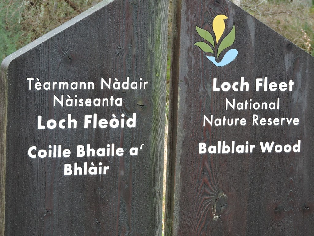
A sign announcing our entry to part of the Loch Fleet National Nature Reserve. Most of you will recall that we had an away weekend walk at the very first NNR declared in Britain.
Balblair is an Anglicisation of the Gaelic Bhaile Bhlair. Coille means wood. Bhaile is a township and Bhlair is a flat moor. So the name would suggest that there was a township on the moor here at one time and the woodland has taken up that name.
There certainly is some archaeological evidence to suggest ancient habitation around the woodland.
These woods we walked beside are commercial plantation.

In among the planted trees, there are odd wild trees, such as this Holly. Holly is a very ancient species, having been around in one form or another for over 145 Million years. Yep! 145 Million years. The Druids thought it deterred evil spirits.

Away from the evergreens, there is still a bit of autumn colour about.

Almost unexpectedly we emerge from the woodland onto the wide mudflats of Loch Fleet. This area is internationally important, mainly for its wintering bird populations, but also for osprey and for the wide range of coastal habitats to be found. It is very nice to look at as well. Although Hugh seems to take a different view.

We start to walk around the shoreline towards Littleferry.

On the South shore of the Loch sits Skelbo Castle. The name is entirely Viking - meaning Shelly Farm, as in there are lots of sea shells!
The Castle dates from the 14th Century and the site is a fine example of a Norman castle of the Motte and Bailey type. The Motte is the raised earthworks on which stood a tower with an enclosed courtyard or Bailey. The earthworks probably date to the Medieval period and the oldest standing ruins date from the 14th Century. It was the seat of the Sutherlands of Skelbo.

One of the reasons Loch Fleet is so important for wading and wintering birds is the ready supply of various types of worms living in the mudflats around the Loch. These provide plentiful and undisturbed (apart from walkers) feeding for a wide variety of birds.

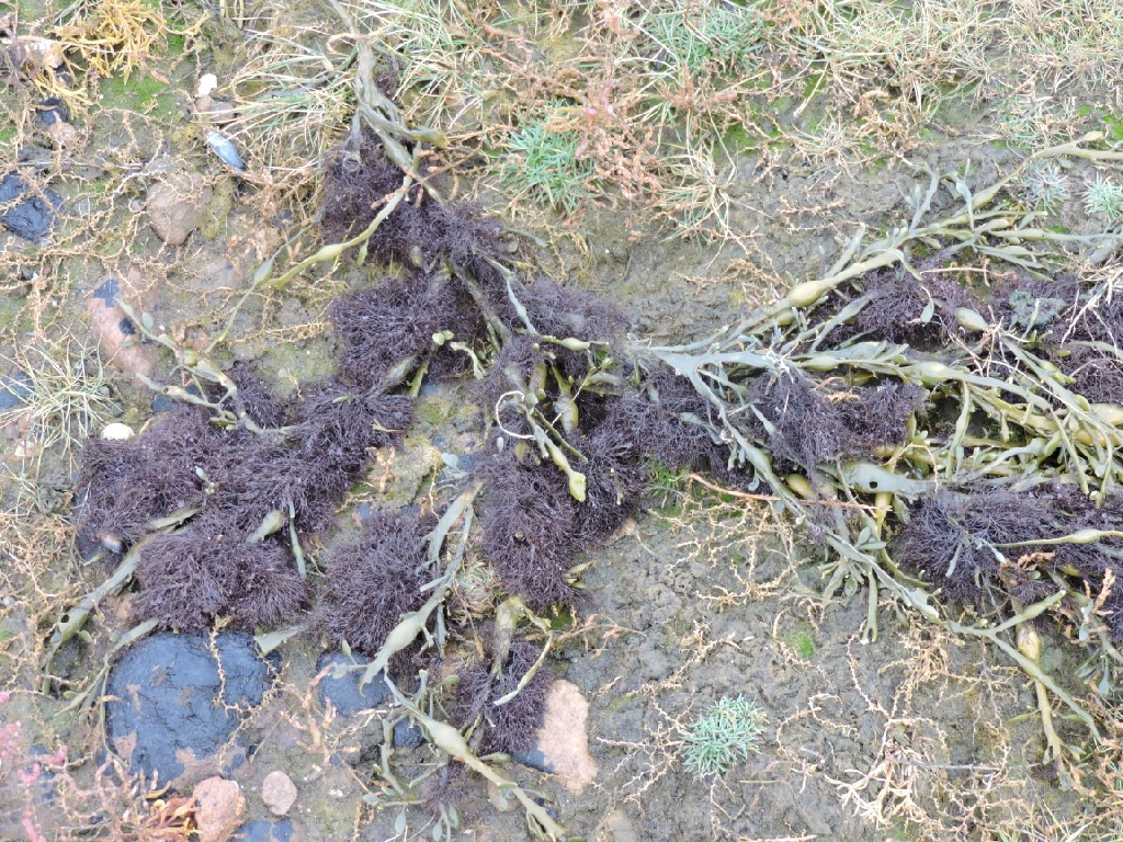
Our walk was quite notable for the different types of seaweed to be seen. I did intend to identify all the various types, but it was taking quite a long time and Sharon said it probably wasn't really necessary! I can hardly believe that but I'll just show the photos instead.

Someone had built a wee path going nowhere.

Continuing round the shore and we get different seaweeds and cows.

There are also birds such as Oystercatcher and Wigeon.

There was a wee flock of wee birds that were too far away and too fast to identify.

This is Egg Wrack.

These are the salt marshes, which are also protected and very important habitats in their own right.

More seaweed.
There were masses of this plant alongside the path as we walked round towards Littleferry. This is Common Scurvy Grass. It flowers early in the year and it was eaten by sailors in the past to ward of scurvy caused by a vitamin C deficiency. The leaves are rich in that vitamin.

I haven't a clue what this little flower was.

Robin spotted these seals on the sandbank. These are Harbour Seals, sometimes called Common Seals. They are not, in fact, common. There are only about 83000 in Europe and over 80% of the UK population are found in Scottish waters.

Sharon found a wee rock that looks a bit like a person or an animal with two wee Barnacles for eyes. This is called anthropomorphism.

There are some fine views west to the Mound. The Mound is the name given to the embankment built by Telford to carry the road and, eventually, the Dornoch Branch Railway. It was 1000 yards long and cost a bit less than £10000 when it was built in 1816.

Goosander on the water.

A dead bird that I have been unable to identify.

Another common or harbour seal has a good look at us. These seals can be distinguished from Grey Seals by their heads which look like a dog's rather than having the long sloping nose of the grey.

Here are his mates on the sand with some calves.

This was the otter that turned out to be just something floating on the surface causing a wave as the tide flowed in.

These were a bit far away, but they look like juvenile Eider Ducks. About 1% of the UK population winters here. We saw lots of geese passing overhead all weekend as well and some 2% of the UK Greylag Goose population can be found here and in summer 10% of all UK Ospreys fish here.

This is The Girnal, a 19th Century grain house. Now it is a holiday cottage sleeping up to ten people.

Here we all are at Littleferry pier.


There is no ferry here and hasn't been since The Mound was built in 1816. It was a difficult crossing and there were many fatalities and accidents, which partly prompted the building of the Mound. The location was strategically important and there were Customs offices, a Pilot's house and the granary. 70 people lived here at one time.
Soon, we turn our backs on the water and head for the cars and lunch at the Carnegie Courthouse in Dornoch. The end of another fine walk.

Lunch at the Courthouse was very good indeed, enlivened by the busyness of the place and the great decor, including this mural showing a range of Dornoch worthies in a court setting. I'm not sure if the implication was that some of them should have been locked up!

My fish finger butty was the best I've had in years. the homemade fish goujons were superb.

After lunch and a quick look in the shops, it was time to go home. It really had been a fabulous weekend with great walks, food, drink, quizzes and company. Many thanks to Hugh and Pam for all their organisation and effort.
Well Done.
posted by bobcam | 7:54:00 PM
|
3 comments
![]()